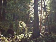
Here on the north-east Olympic Peninsula, we have been spared most significant damages to our regional trees and shrubs from 'The Longest Storm', as it has been dubbed by KIRO 7 News.
First we were blessed (unless you have rear-wheel drive vehicles) with a 2-6 inch blanket of snow which served as a cozy warm comforter for our smaller plants.
While this did do some damage to tree limbs, particularly red alders and older Douglas firs which tend to produce overly long, horizontal limbs, the effects were minimal.
The gravest danger occured after the snow melt when the ground was extremely saturated. Tree roots lose their ability to 'grip' the soil when they are so lubricated by water, and even a moderate wind event (35-45mph winds) can cause a lot of catastrophic tree failures. By this I mean the entire tree topples over.
The most dangerous trees are those compromised by decay or root loss, and especially newly created 'edge' trees. These occur around new developments which are carved out of existing stands of tall trees. These trees have never had the opportunity to develop resistance to high winds, having grown up in a sheltered environment, and are very susceptible to failure.
Remember that our strongest winds typically come from a southerly direction. If you look at previously fallen trees, generally 80% or more have fallen pointing in a northerly direction.
While this doesn't absolve other wind gusts of all danger; westerlies and northerlies have, on rarer occasions, have caused significant damage, generally because trees have not built up resistance to winds from this direction.
As our soils dry out this week, the liklihood of total tree failure will lessen.
Also on the bright side, buds are swelling and one year old wood is showing color. This means the Indian Plum blooms and the light at the end of our winter tunnel is in sight.
Subscribe to:
Post Comments (Atom)
No comments:
Post a Comment